
Over the Victorian Alps
Alps - What Alps?
As far as mountain heights are concerned, Australia is in a very minor league compared with many other countries.
The highest mountain in Australia, Mount Kosciuszko,is
2228 metres (7310 feet) above sea level.
Mount Bogong is the highest in the state of Victoria at 1986 metres (6516 feet).
So, while it may sound dramatic to refer to a trip over the Victorian Alps in a pre-war Morris 850, the reality is not as daunting as ,say, a trip over the European Alps. (See photo below left).
A list of mountains in the Victorian Alps can be accessed from a link near the bottom of this page.
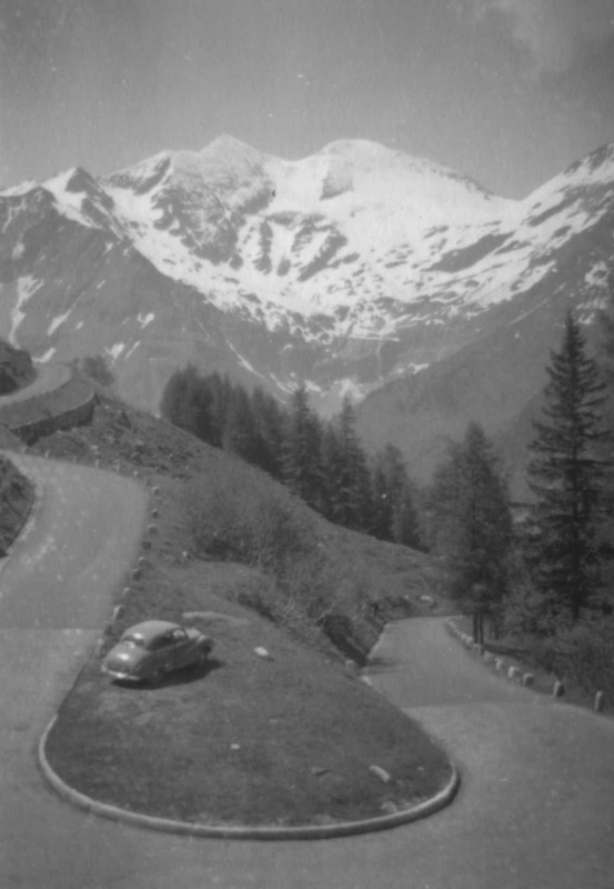
A hair-pin bend on Hochalpenstrasse, a road high in the Austrian Alps. #
|
Mount Kosciuszko , NSW. #
|
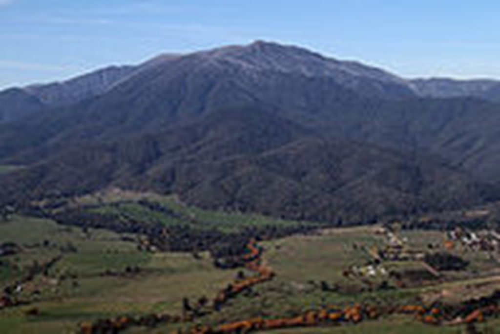
Mount Bogong, Victoria. Photo by John O'Neill (JJRon) per Wikepedia. #
|
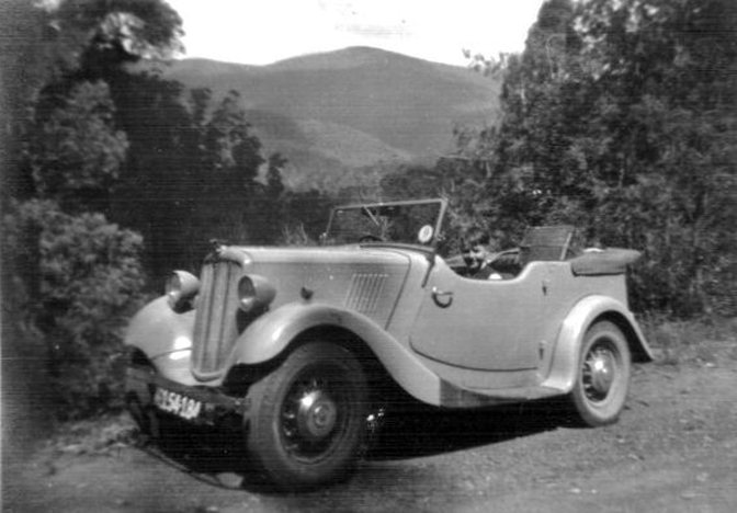
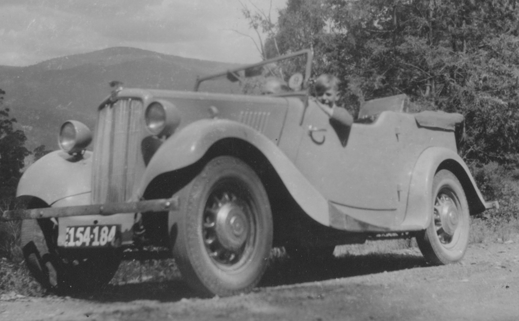
The "intrepid" journey began on 11 January 1949 from the Melbourne suburb of Ormond and ended eleven days later after traveling almost 1000 miles (1600 km).
The first stage of the journey involved using the Prince's Highway into Gippsland, and the first photos were taken in the Gippsland town of Yallourn.
The first stage of the journey involved using the Prince's Highway into Gippsland, and the first photos were taken in the Gippsland town of Yallourn.
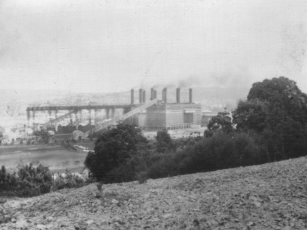
Above and below:
Views of the Yallourn Power Station complex as at 11 January 1949. At the time the station supplied the bulk of Victoria's electricity needs.
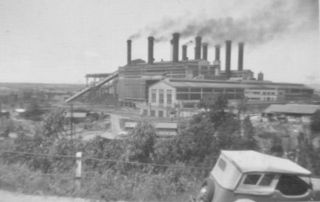
The power complex also included a briquette factory using brown coal from an adjacent open cut mine. Photo 11 January 1949.
The town of Yallourn was built between the 1920s and 1950s to house employees of the State Electricity Commission of Victoria, who operated the Power Station complex.
Electricity was generated by boilers fired by brown coal from an adjacent open cut mine.
Expansion of the mine led to the closure and removal of the town in the 1980s.
Electricity was generated by boilers fired by brown coal from an adjacent open cut mine.
Expansion of the mine led to the closure and removal of the town in the 1980s.
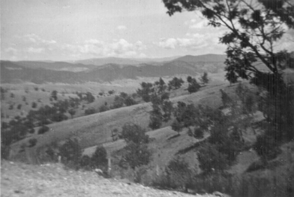
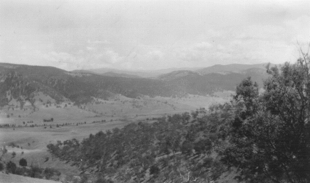
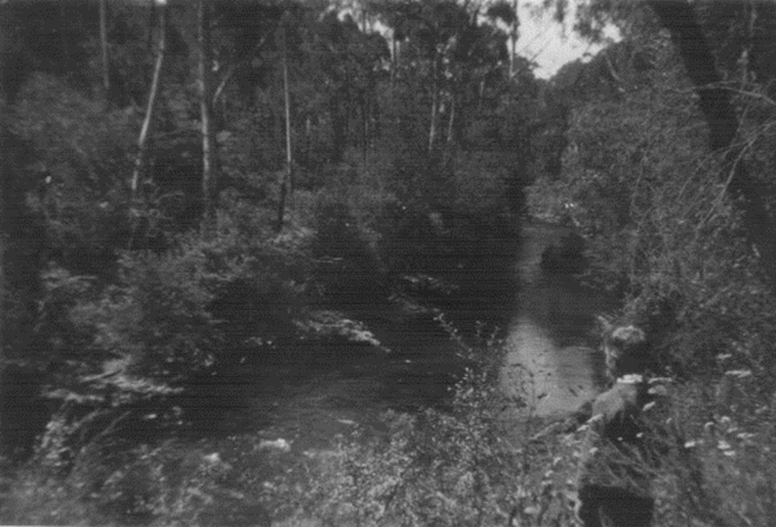
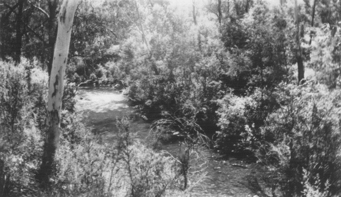
The locations of the photos above and below cannot be recalled. However they were taken on 11 January1949, and are thought to be scenes of the Yallourn District.
Sale
On 11 January 1949, the first day of the trip over the Victorian Alps, the trio visited the Gippsland town of Sale. They spent just 10 minutes in the town, which became a city the following year.
Had Alan and Keith known they had a strong family link with Sale, they may well have spent more time there and done some extensive sightseeing.
They were unaware until more than six decades later that their great grandfather and his family had been long-time residents of Sale from 1866.
George Wynd , their great-grandfather , became a prominent citizen of Sale during his life there of nearly 50 years.
His work as a building contractor and master builder gained renown. Among his many fine legacies in Sale are the Catholic and Anglican Cathedrals, several business premises and some prestigious private homes.
Further details of the Wynds of Sale are included in a website “Memories of my early years in Malvern”. You can go to the relevant page by clicking here.
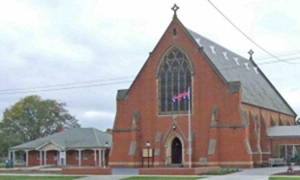
St Paul's Cathedral , the cathedral church of the Anglican Diocese of Gippsland in Australia, was built in 1884 by Alan and Keith Wickenton's Great-Grandfather, George Wynd. #
|
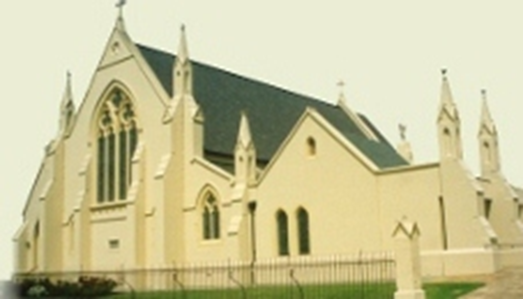
St Mary's Cathedral, the cathedral church of the Catholic Diocese of Sale covering the south east of Victoria, was built in 1886.. by Alan and Keith Wickenton's Great-Grandfather. #
|
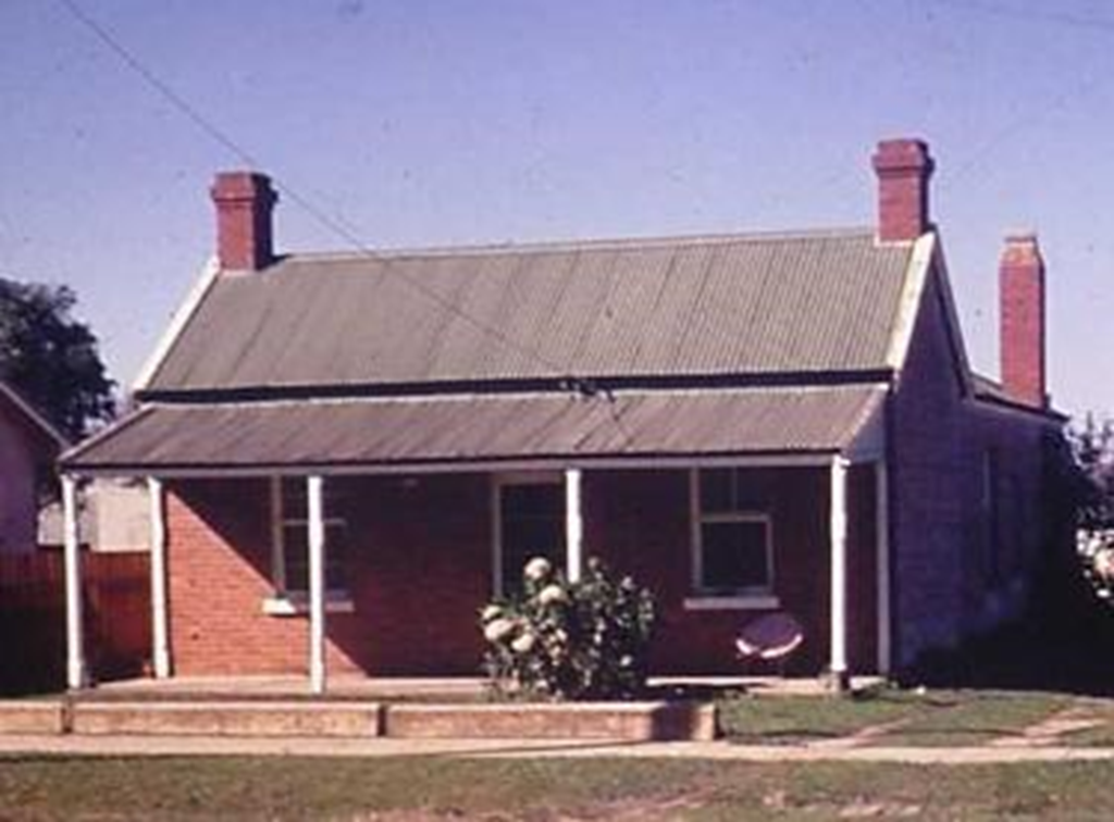
The former home of the Wynd family in Dundas Street, Sale. The house was demolished many years ago, but would still have been standing when the boys visited Sale in 1949. #
|
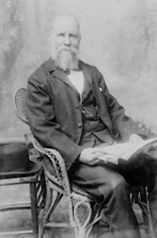
Master Builder, George Wynd,of Sale, a Great-Grandfather of Keith and Alan Wickenton . #
|
Lakes Entrance
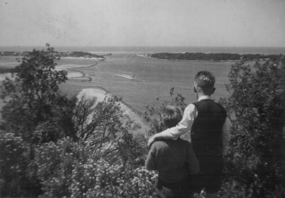
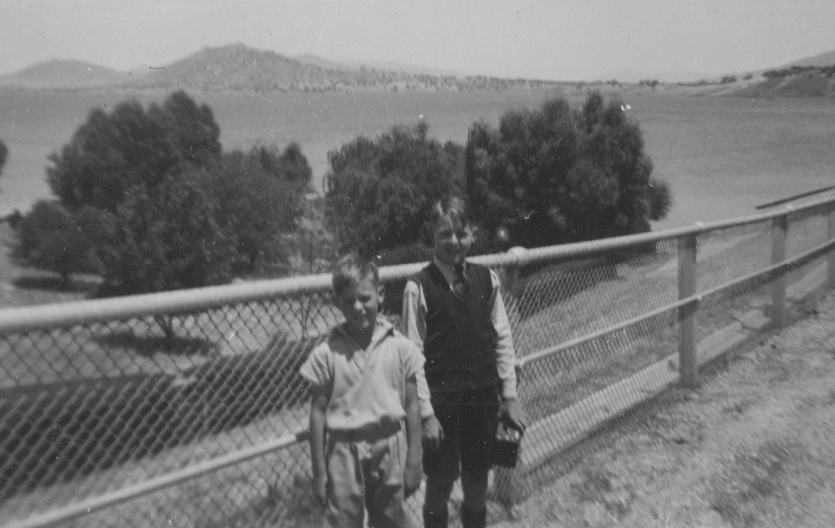
Keith (L) and Alan Wickenton (R) viewing the entrance to the Gippsland Lakes from Jemmie's Point or Jemmy's Point or Jimmy's Point,The point was named after the Aborigine, Jimmy Gibber who traveled with British explorer, Angus McMillan on his Gippsland expedition in 1839. Photo taken 12 January 1949.
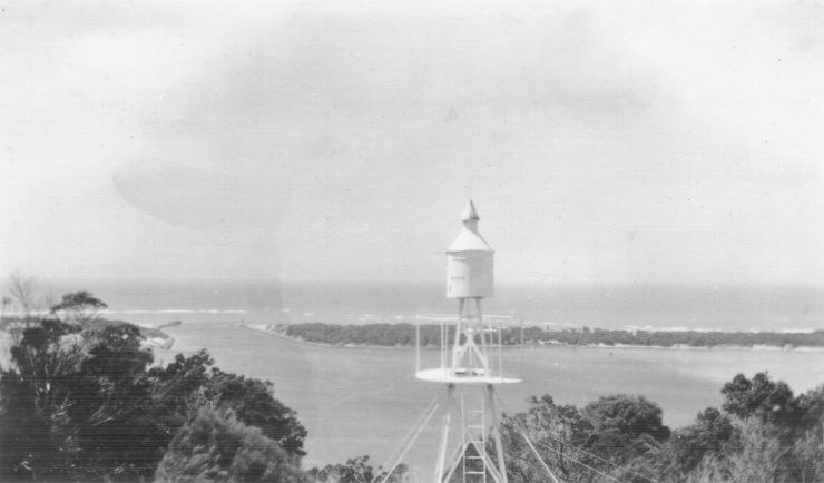
The beacon on Jemmy's Point. Looking to the man-made channel connecting the Gippsland Lakes to the Bass Strait. The opening was made in 1889, and requires regular dredging . Photo taken 12 January 1949.
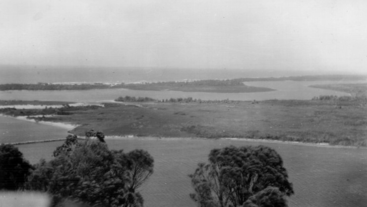
The Gippsland Lakes consists of a group of coastal lagoons and marsh environments that are separated from the sea by a barrier system of sand dunes and fringed on the seaward side by the Ninety Mile Beach.
The main lagoons/lakes are fed by a number of river systems. Photo taken 12 January 1949.
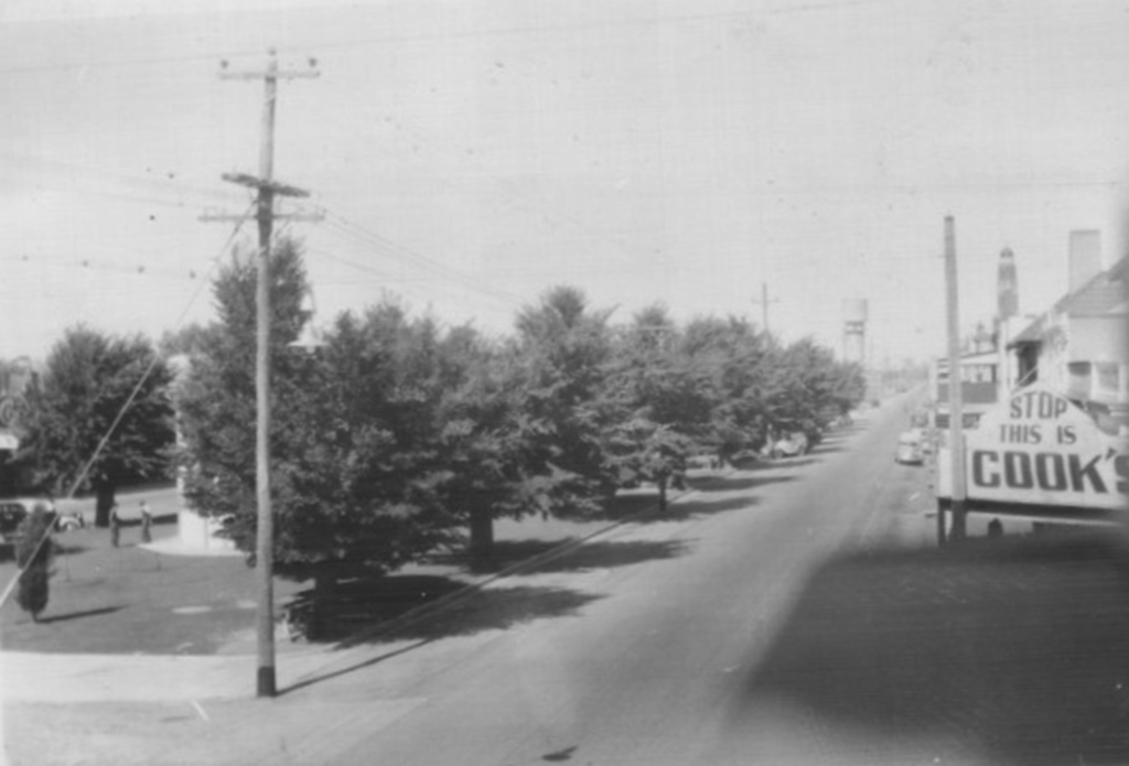
Main Street of Bairnsdale Victoria, then part of the Prince's Highway. Photo from balcony of the Commercial Hotel 11 January 1949
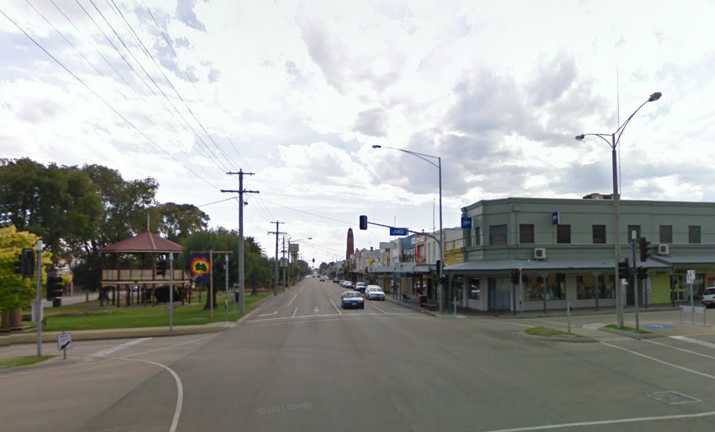
Same view at ground level from in front of the Commercial Hotel 61 years later. Photo from Google Maps.
Buchan Caves
A short detour off what is now the Great AlpineRoad after leaving Lakes Entrance takes tourists to Buchan and the Buchan Caves.
The caves were created almost 400 million years ago by underground rivers cutting through limestone rock.
The calcium carbonate which forms the basis of the limestone formations in the area's 350 or more caves derives from the skeletons of shellfish and coral which were deposited when the sea still covered southern Gippsland.
Rainwater that trickles into the caves forms spectacular stalactites and stalagmites which sometimes meet to form impressive pillars, or waterfall-like structures, due to the passage of the water over ledges.
Red and brown colourations are caused by the presence of iron oxide while green shades are caused by copper.
The Aboriginal Traditional Owners of the Buchan area are the Gunaikurnai People.
Evidence of their long association with the area has included the discovery of fire hearths, middens, rock paintings, burnt bones, and tools such as pebbles for burnishing skins, scrapers, blades, pebble choppers and awls for piercing holes in skins for the manufacture of skin cloaks. These items have been dated to as old as 17 000 years ago.
The remains of extinct species, including a kangaroo the size of a horse, the Tasmanian Wolf and a Tasmanian Devil now extinct in the area, have also been uncovered.
The trio visited the Royal Cave which was discovered in 1910 by Frederick Wilson. After an entrance tunnel was excavated, it was opened to visitors in 1913.
Some 80 minutes were spent viewing the cave. As few tourists at the time had flash guns on their simple cameras, which included us, postcards are used in the slideshow below to show some of the cave’s spectacular beauty.
The postcards are no longer under copyright restrictions.
Royal Cave, Buchan
On the track
Alan Wickenton in the Morris 850 on the Benambra to Corryong Road. The site gave a clear view to
Mount Gibbo at top of photo. Mt Gibbo is 1757 metres (5764 ft) above sea level. Photo: 13 January 1949
Arthur Shannon at wheel and Keith Wickenton in passenger seat on Benambra to Corryong Road. Mt. Gibbo in background.
Photo 13 January 1949
The section of the Alps Trip between Ensay South and Tintaldra on Thursday 13 January 1949 provided a variety of beautiful views. These included creeks and rivers running between mountain ranges and wide views across to alpine peaks.
Some of the day's highlights were a picnic lunch beside Morras Creek, views of Mount Gibbo (1757m/5764ft)
above sea level, Sassafras Gap (4256ft above sea level),
expansive views from a section of road 4256 ft above sea level,and a view of Australia's highest mountain Mount Kosciusko.
The Gibbo River pictured below, with Keith Wickenton standing in the right foreground, ran beside the route of the road for many miles.
Keith Wickenton on the bank of the Gibbo River. 13 January 1949
Morras Creek, north of the town of Benambra,Gippsland. 13 January 1949
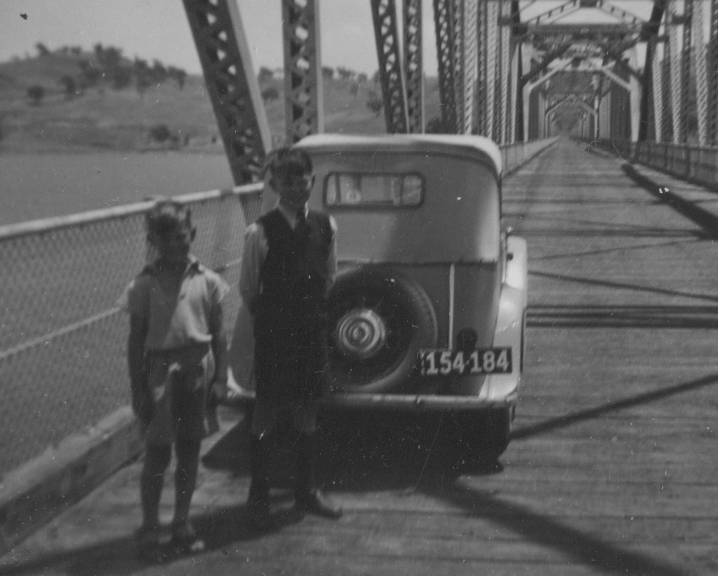
Walwa-Jingellic Bridge
The Walwa-Jingellic Bridge across the Murray River.Photo taken 14 January 1949. It was replaced by a new bridge 10 years later.
Detail of timber truss on the old Walwa-Jingellic Bridge. 14 January 1949
Looking upstream from the Wala-Jingellic Bridge over the Murray River. !4 January 1949
All that's left of the old Jingellic bridge.
Photo from Wikipedia.
Work on building the Walwa-Jingellic Bridge was begun in 1887 but the structure was not not opened until 1892.
A new a steel truss bridge , which bypasses the town, was built in 1959.
The remnants of the old bridge are upstream of the present bridge. They consist of metal pylons standing in the river.
These remains are seen as significant by the New South Wales Roads and Traffic Authority as "a representative example of a method of bridge building which is no longer used”.
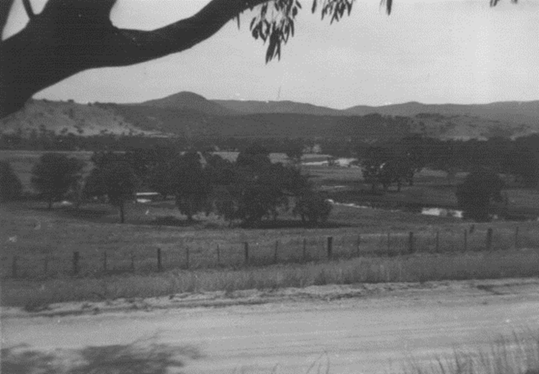
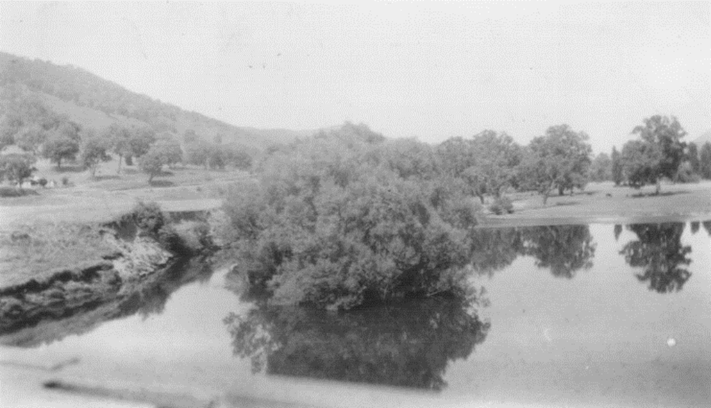
A view in the Upper Murray Valley, Victoria. Photo taken 14 January 1949
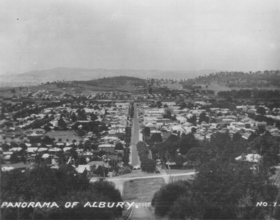
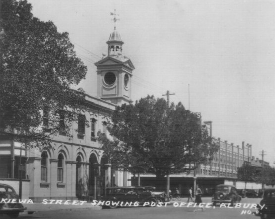
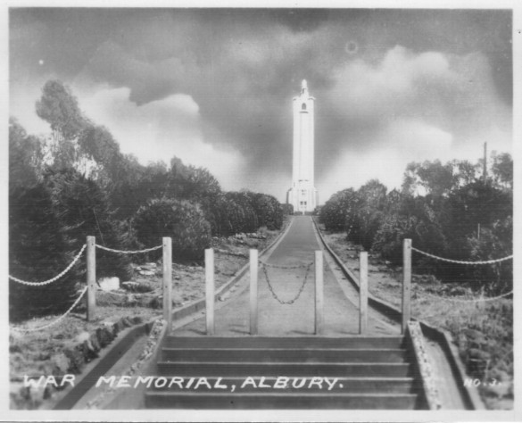
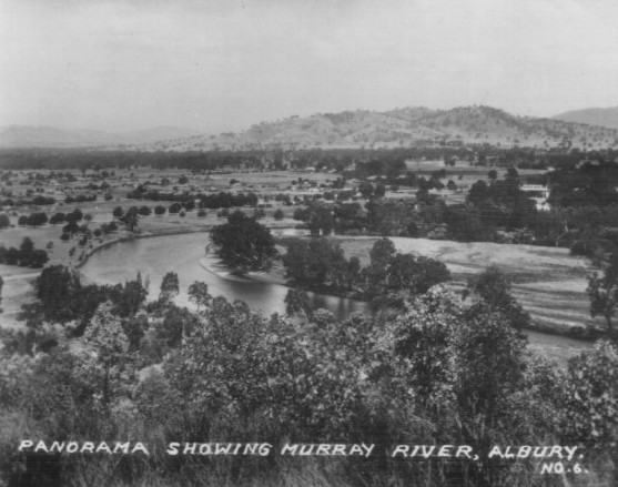
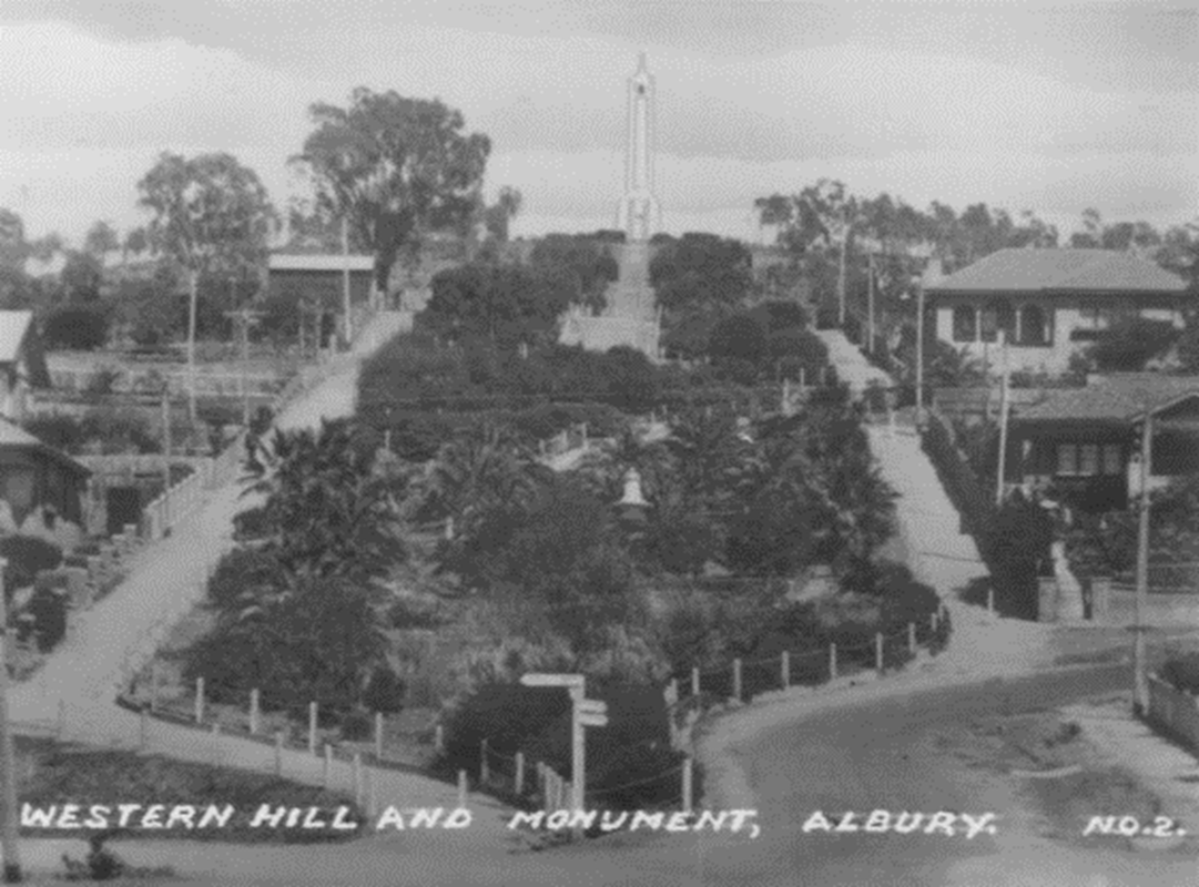
Albury and District
After passing over the Victorian Alps the journey continued along the Murray River Valley and took in the NSW City of Albury.
Below are small commercially produced photos of the Albury district purchased at the time, 14 January 1949.
#
Below are small commercially produced photos of the Albury district purchased at the time, 14 January 1949.
#
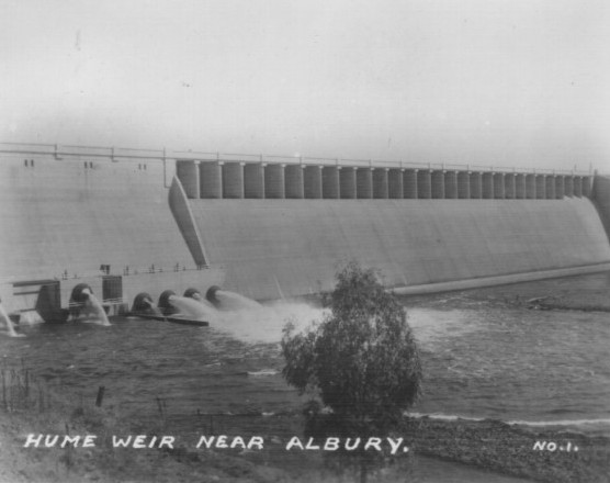
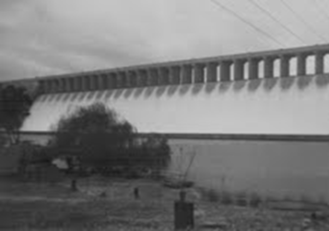
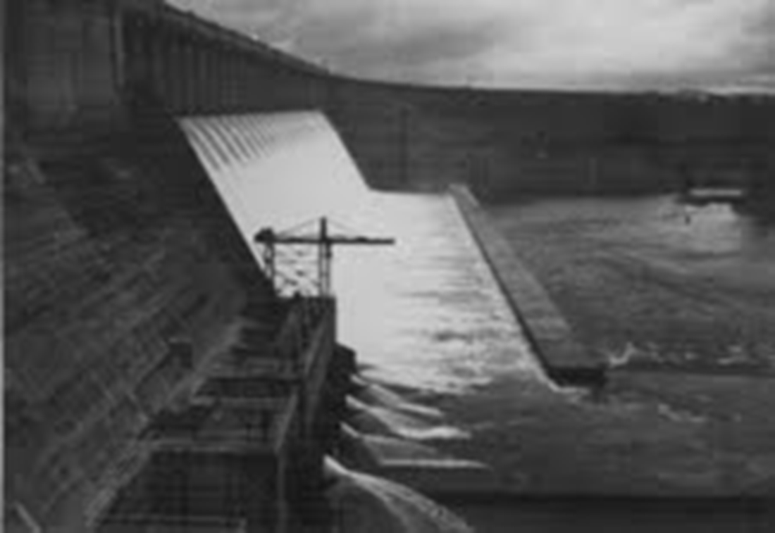
The Hume Weir
#
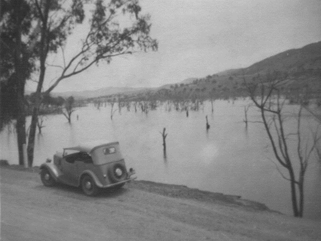
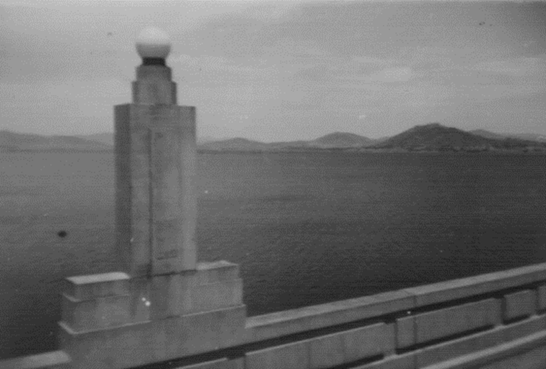
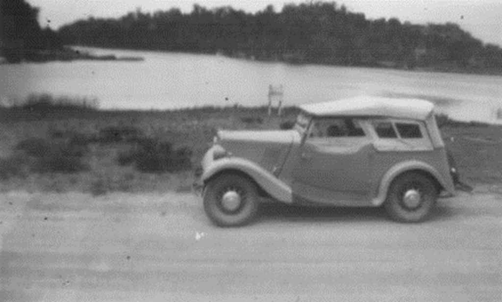
Morris 850 Tourer beside an arm of the Hume Dam, later known as Lake Hume. Photo taken 14 January 1949
Lake Hume, formerly the Hume Reservoir,was constructed over a 17-year period between 1919 to 1936.
The Hume Dam wall is located about 27 kilometres (17 mi) east of the city of Albury.
The dam's purpose includes flood mitigation, hydro-power, irrigation, water supply and conservation.
Water is retained nearly 40 kilometres (25 mi) upstream of the reservoir in the valleys of both the Murray and Mitta Mitta rivers.
The dam wall height is 51 metres (167 ft) and the crest is 1,615 metres (5,299 ft) long with the auxiliary embankments extending a further 1,010 metres (3,310 ft).
The maximum water depth is 40 metres (130 ft).
The dam wall was extended during the 1950s, and completed in 1961.
This raised the water level which resulted in the town of Tallangatta having to be relocated to a new site about 8 kilometres to the west.
In the early 1990s it was found that the water pressure and leakage had caused the dam to move slightly on its foundations . There were concerns that the dam was heading for collapse, threatening Albury-Wodonga and the entire Murray basin.
Remedial work commenced , including building a secondary earth wall behind the original to take the strain.
Further upgrades to the dam, to cost estimated A$60 million, began in 2010 and are due for completion in
2015.
#
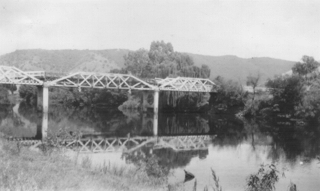
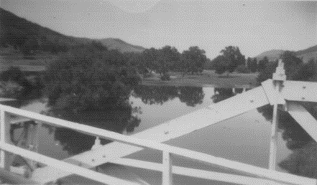
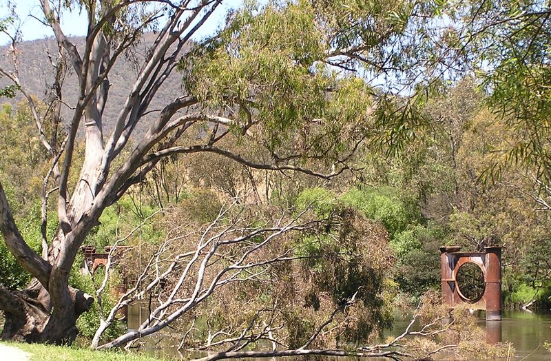
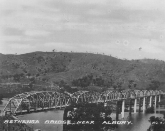
Bethanga Bridge
The Bethanga Bridge, was built between 1927 and 1930 as a joint venture between New South Wales and Victoria as part of the Hume Dam project.
The road bridge spans a flooded section of a Murray River valley that now forms part of the Hume Dam.
It has nine spans, each being 82 metres long.
Each span is supported between double reinforced concrete pylons by a riveted steel camel back Pratt truss.
With a 14 metre approach span on the New South Wales side, the bridge has an overall length of 752 metres.
The road deck is 7.7 metres wide.
As seen in the photos taken in early 1949, the road deck was initially of timber . However the timber decking was replaced in 1961 with a concrete slab deck.
At the same time, the deck and truss structure was raised by 300mm to cope with a higher water level resulting from upgrading works on the Hume Dam and an increase in the dam’s storage capacity.
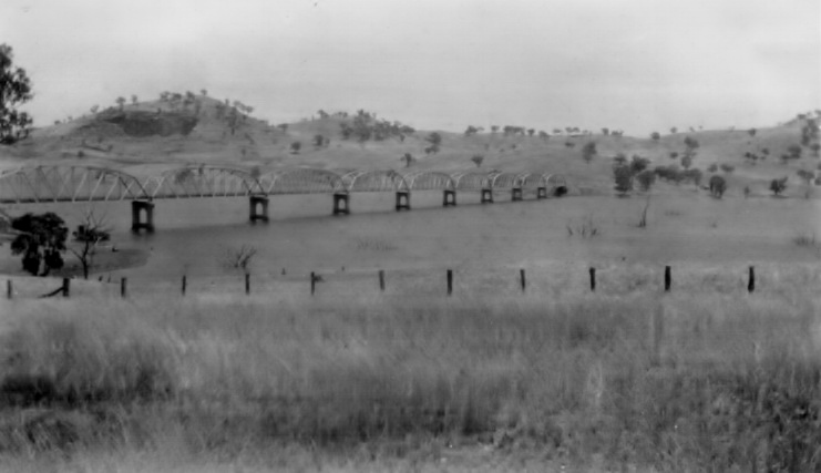
Bethanga Bridge. Photo 14 January 1949
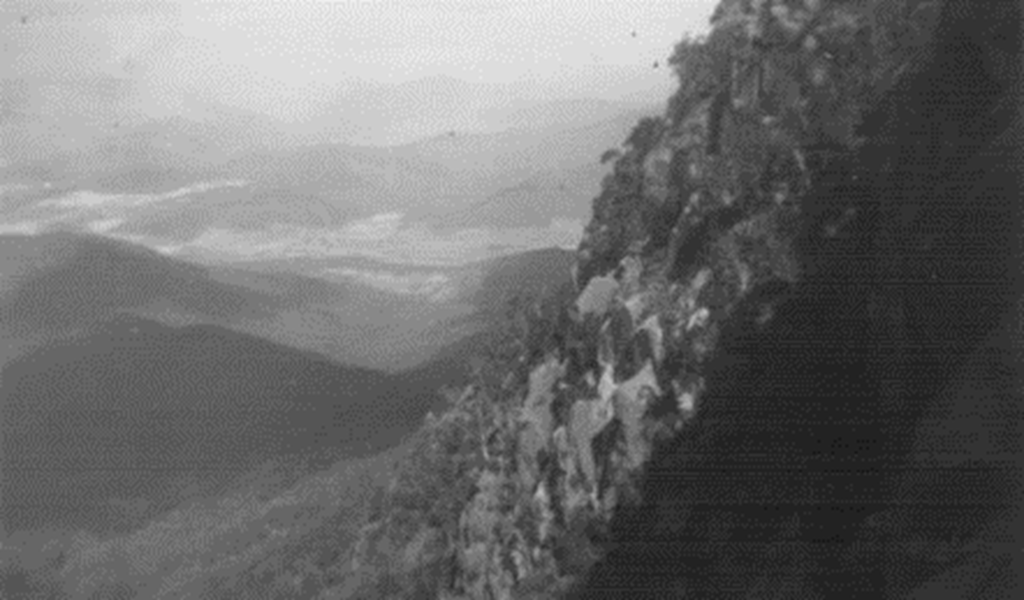
Mount Buffalo
Mount Buffalo is a mountain plateau on the west side of the Victoria Alpine region. At its highest point the mountain is 1723 metres above sea level. The highest accessible point is a prominent peak called The Horn. From its top visitors can enjoy a 360 degree view which takes in many of Victoria’s highest mountains. On a clear day it’s possible to see, Kosciusko ,Australia’s highest mountain, across the border in New South Wales.
The top of Mount Buffalo is strewn with many huge granite boulders and rock formations.
A long day was spent exploring the mountain's many features on 15 January, 1949. These included, a meal at The Chalet, ski runs,Lake Catani, The Monolith, The Leviathan, Torpedo Rock, The Horn, Echo Point, The Gorge,waterfalls, Billson’s Lookout and Bent’s Lookout.
View from The Gorge, Mount Buffalo, to the Ovens Valley below. Photo taken 15 January 1949
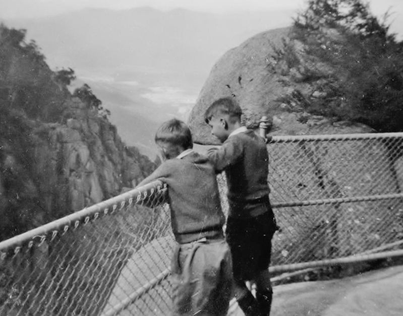
Keith and Alan Wickenton looking down the Gorge at Mount Buffalo, Victoria. 15 January 1949
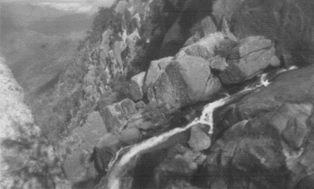
The Gorge and its waterfall, Mount Buffalo, 15 January 1949
Spectacular view from Mount Buffalo to the valley below. Photo 15 January 1949
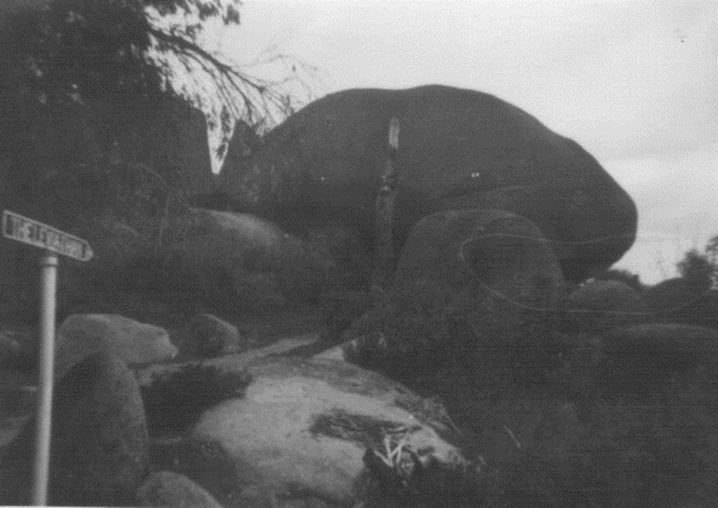
The Leviathan , Mount Buffalo 15 January 1949
The Leviathan
The Leviathan is one of the many huge granite boulders located across Mount Buffalo.
This egg-shaped boulder is 33 metres long, 12 metres high and weighs an estimated 30,000 tonnes.
The Leviathan is one of the many huge granite boulders located across Mount Buffalo.
This egg-shaped boulder is 33 metres long, 12 metres high and weighs an estimated 30,000 tonnes.
Morris 850 beside Lake Catani on Mount Buffalo 15 January 1949
Lake Catani
Carlo Catani was a civil engineer born in Italy in 1852 who was involved in many public works throughout Victoria from 1880 until his retirement in 1917.
The public works included opening up the Mount Buffalo Plateau for tourism,and damming Eurobin Creek to form the lake which bears his name.
Carlo Catani was a civil engineer born in Italy in 1852 who was involved in many public works throughout Victoria from 1880 until his retirement in 1917.
The public works included opening up the Mount Buffalo Plateau for tourism,and damming Eurobin Creek to form the lake which bears his name.
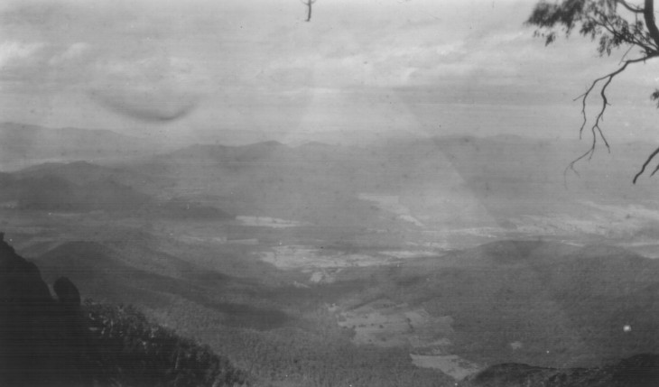
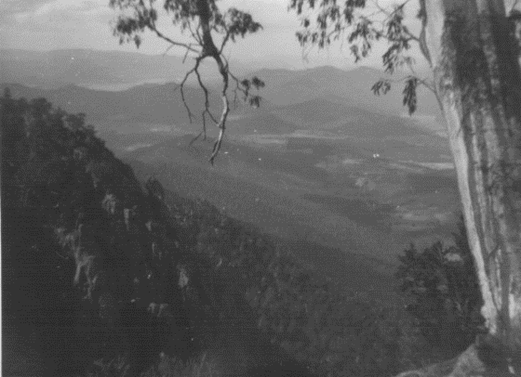
A shaft of sunlight through the clouds illuminates part of the Oven Valley seen from Mount Buffalo. Photo 15 January 1949
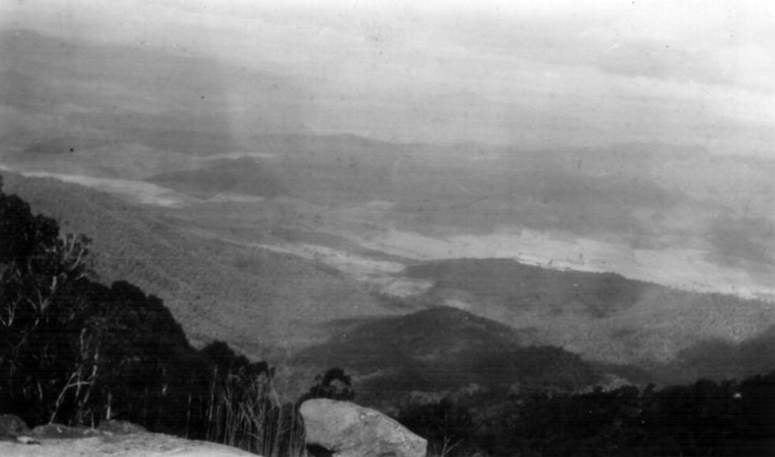
Another expansive view from Mount Buffalo. Photo taken 15 January 1949
A list of Victorian Mountains, in descending order of their height, has been compiled by Bonzle.Com
You can see the list be clicking Here.
The Spirit of Progress
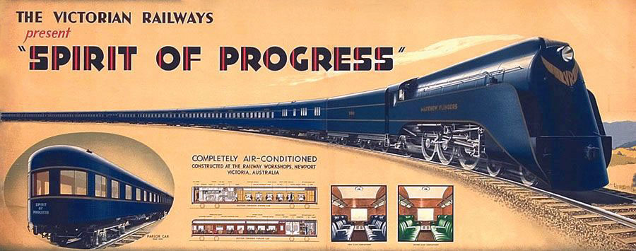
Late on the last day of the Alps trip (22 January 1949) we enjoyed a first sighting of the then premier passenger train in Australia, the Spirit of Progress.
The distinctive streamlined locomotive with its matching passenger carriages sped under a road bridge on the Hume Highway between Tallarook and Broadford, north of Melbourne.
We had timed our arrival at the bridge to coincide with the time the express train was expected to pass.
The non-stop Spirit of Progress service between Melbourne and Albury NSW was introduced in November 1937.
Wikipedia has a detailed article on the famous train, which you can go to by clicking the photo of it below.
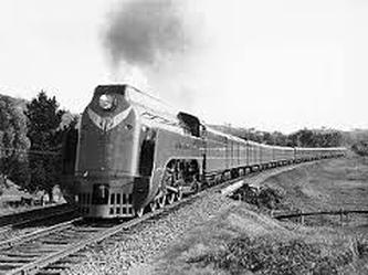
The Spirit of Progress headed by S 301 Sir Thomas Mitchell near Kilmore East in 1938 (Photo: John L Buckland)
