
Adelaide and Surrounds
They went that-a way!

Montefiore Hill and Colonel Light's statue, January 1951
Overlooking the City of Adelaide, a statue of Colonel William Light, the first Surveyor-General of the Colony of South Australia.
Legend has it that William Light stood on Montefiore Hill in 1837, pointed at what would one day become the Adelaide city centre, and said "This is the place for a city".
As well as choosing the site, he designed the layout of the city's streets and parks.
Legend has it that William Light stood on Montefiore Hill in 1837, pointed at what would one day become the Adelaide city centre, and said "This is the place for a city".
As well as choosing the site, he designed the layout of the city's streets and parks.
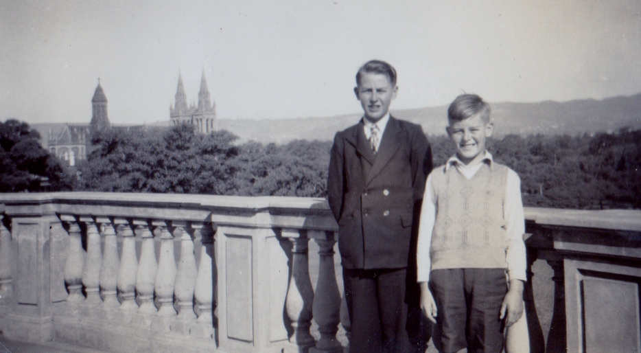
Alan and Keith Wickenton pose with a View of Adelaide from near Light's statue on Montefiore Hill. January 1951
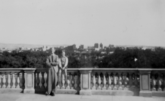
Arthur Shannon and Keith Wickenton with another view over Adelaide City from near Light's statue on Montefiore Hill.
January 1951
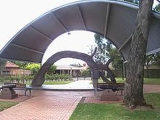
The Proclamation Tree
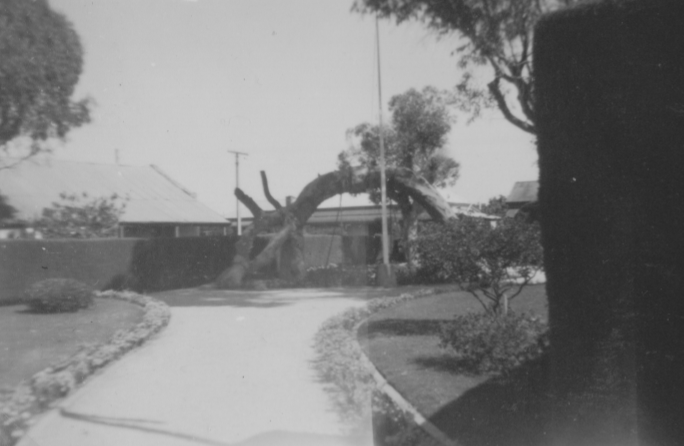
The Proclamation Tree at Glenelg January 1951
The Old Gum Tree is a historic site in the Adelaide suburb of Glenelg.
Legend has it that the tree, which is thought to be a red gum, was blown over in a storm and continued to grow with a curvature.
It was here on 28 December 1836, the British governor John Hindmarsh delivered the proclamation creating the colony of South Australia.
A ceremony is held each year on Proclamation Day, with the current Governor reading out Hindmarsh's original speech.
An oil painting depicting the 1836 ceremony shows the bent tree with several live branches extending from the trunk.
Another oil painting created two years later in 1838 shows the tree still sprouting. But by 1880, as shown in a photograph, the tree is dead.
When the photos above and below were taken, the original trunk of the tree was still in place.
But, since 1963 the trunk has been encased in a coating of concrete. In 1988 a canopy was built over the tree for further protection against the elements.
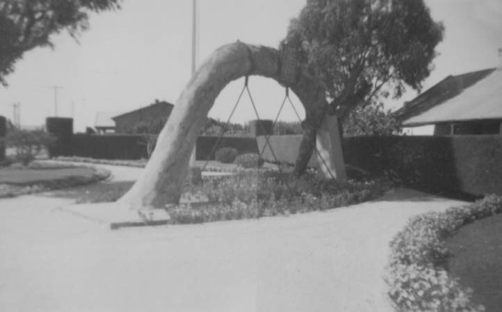
The Proclamation Tree at Glenelg, January 1951
|
Left: The site as it is now. Photo from Wikipedia. |
Adelaide Mosque
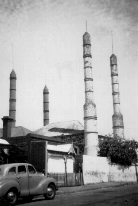
The historic Adelaide Mosque. While it was the first mosque built in a major Australian city, it was not Australia's earliest. The first mosque in Australia was built at Marree in northern South Australia in 1861. It was made of mud brick and built by the Afghan cameleers employed at Marree's inception. Photo: January 1951
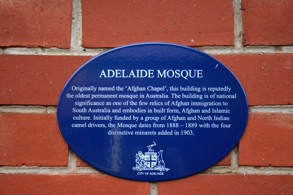
Plaque attached to Mosque many years after the previous photo was taken in January 1951
Waterfall Gully
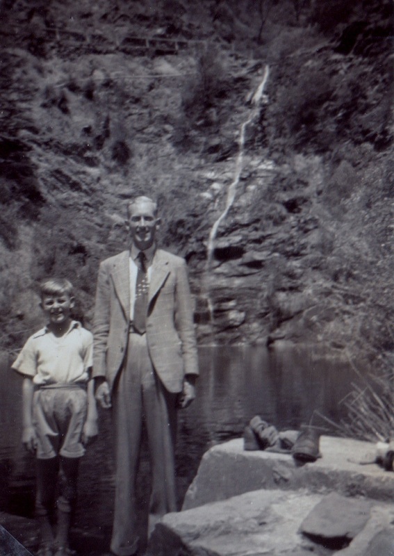
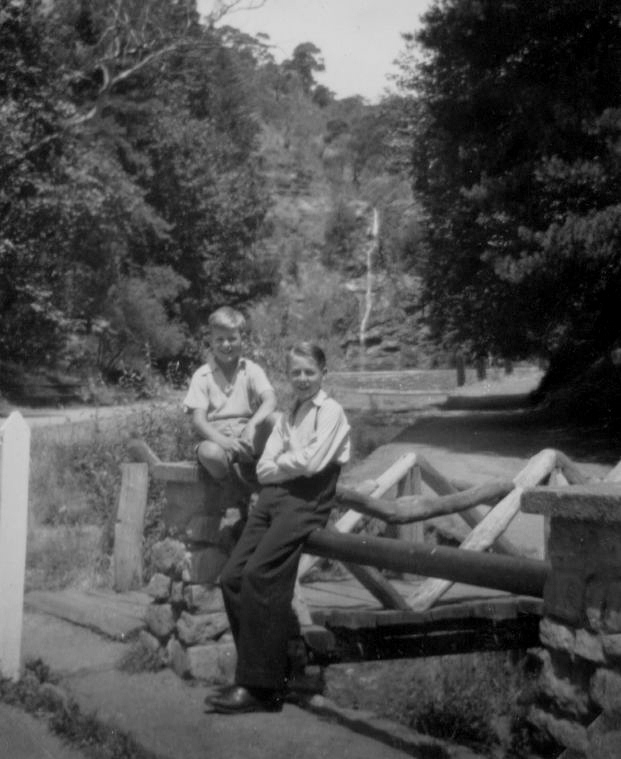
Keith Wickenton and Arthur Shannon at Waterfall Gully in the Adelaide Hills.
January 1951
Waterfall Gully is located in the foothills of the Mount Lofty Ranges around 5 km (3.1 mi) east-south-east of the Adelaide city centre.
A weir at the bottom of the Waterfall was constructed in the late 19th century and was part of Adelaide's early water supply.
The area around the waterfall is a conservation park. While, further up the gully a suburb has been developed over the years, and takes it name from the water fall.
A weir at the bottom of the Waterfall was constructed in the late 19th century and was part of Adelaide's early water supply.
The area around the waterfall is a conservation park. While, further up the gully a suburb has been developed over the years, and takes it name from the water fall.
Keith and Alan Wickenton at Waterfall Gully in the Adelaide Hills. January 1951
Torrens Gorge
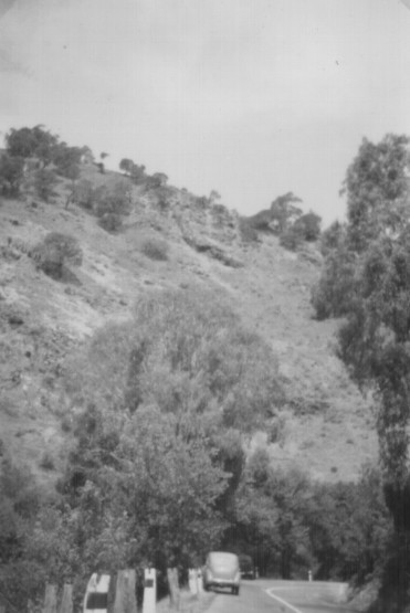
In the Torrens Gorge January 1951
The Torrens River was one of the reasons for the location of Adelaide.The upper stretches of the river, and the reservoirs in its watershed , contribute a significant part of the city's water supply.
The Torrens flows 85 kilometres (53 miles) from its source in the Adelaide hills, past the city centre, and empties into St. Vincent’s Gulf.
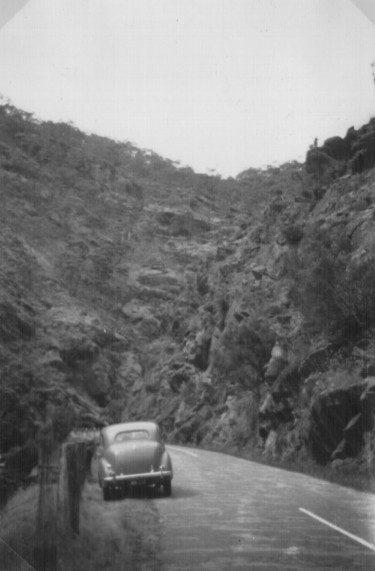
The photos above and below were taken in a section of the Torrens River Gorge upstream from Adelaide in mid-January 1951. The road has since been named as Tourist Road 58.
The Torrens flows 85 kilometres (53 miles) from its source in the Adelaide hills, past the city centre, and empties into St. Vincent’s Gulf.
The photos above and below were taken in a section of the Torrens River Gorge upstream from Adelaide in mid-January 1951. The road has since been named as Tourist Road 58.
Torrens Gorge January 1951
Hawthorndene
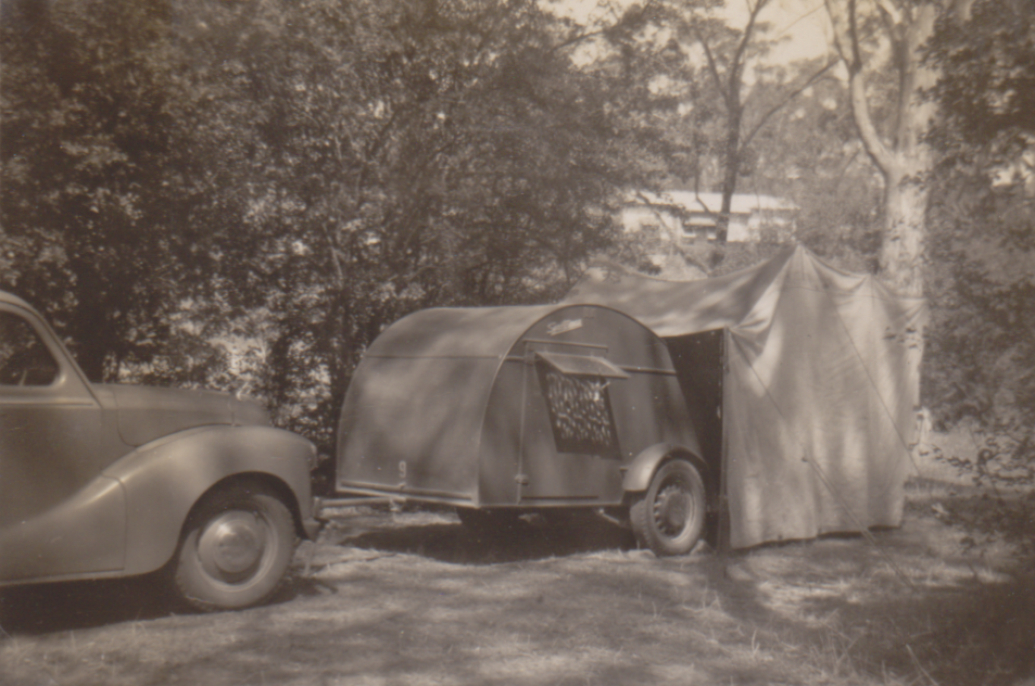
Three photos above show our base camp at Hawthorndene , used while visiting Adelaide from 14 January to 22 January 1951.
At the time it was a sparsely populated southern suburb in the Adelaide Hills.
The subdivision of Hawthorndene was created in 1925.
It name came from the many Hawthorn bushes growing along Minno Creek.
The bushes grew from seeds washed down the creek from a Hawthorn maze planted in the Belair National Park.
A Hawthorn hedge surrounding a large upstream orchard is also thought to have contributed to the seed bank.
Bridgewater Mill
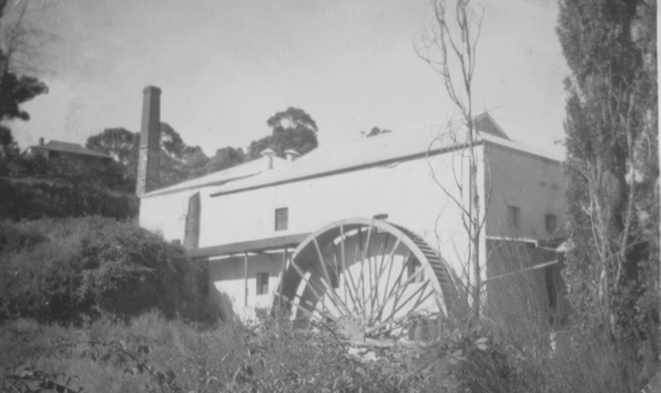
The Bridgewater Mill in the Adelaide Hills,
dates from the late 1850s.
The huge wheel harnessed water power to operate stone grinders which crushed wheat into flour.Photo taken 13 January 1951.
Mount Lofty
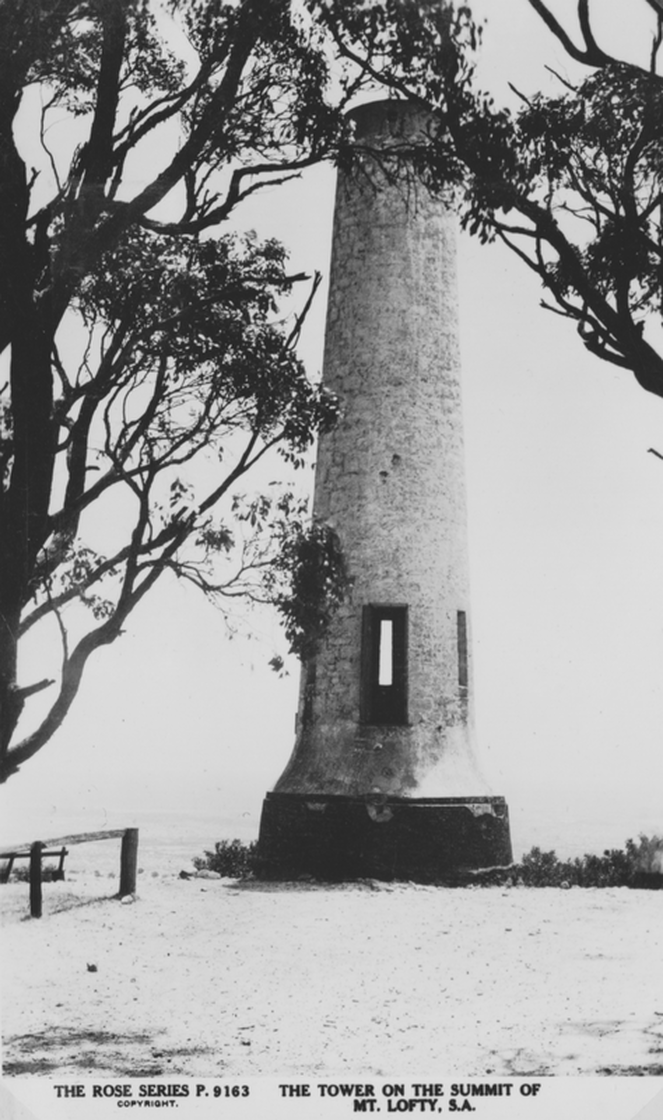
Above : Postcard purchased January 1951 showing Flinders Column on Mount Lofty, which overlooks Adelaide.
The column was built about 1887 to honour Matthew Flinders, the Captain of the Investigator who sighted and named Mt Lofty from Kangaroo Island in March 1802.
The then Governor of South Australia, Lord Tennyson
( eldest son of the famous poet) unveiled a tablet on the column exactly 100 years later ( photo below).
Flinders Column has been used by surveyors as the central "trig" in the State,but it has never been used for its original purpose as a meteorological observatory.
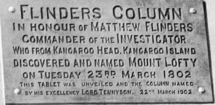
Plaque on Flinders Column, Mount Lofty
Victor Harbour
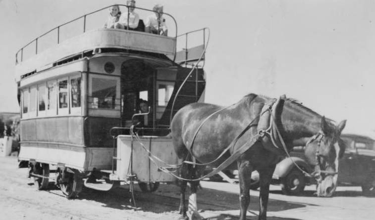
Postcard purchased January 1951 at Victor Harbour : Old horse tram
Morialta Gorge
#
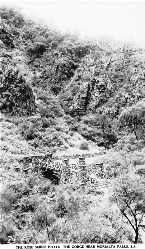
Another postcard from January 1951 .
The Morialta Gorge near Adelaide is now within the Morialta Conservation Park at the base of the Adelaide Hills. The park is well known for its impressive seasonal waterfalls, deep gorges and lush, wooded hillsides.
It’s a popular place for rock climbers, abseilers and bushwalkers of all abilities. #
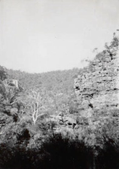
Snapshot taken mid-January 1951 of Morialta Gorge, near Adelaide
Observation Point
Postcards purchased mid-January 1951 with views over Adelaide by day and at night.
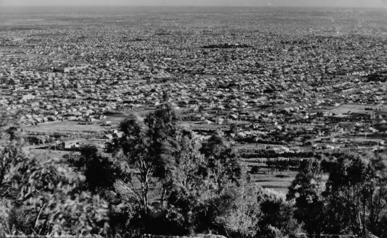
Adelaide by day from Observation Point
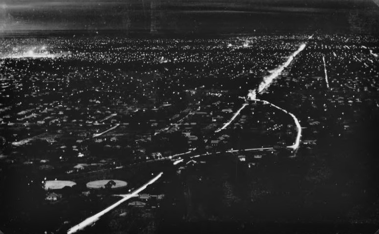
Adelaide by night from Observation Point
The postcards are captioned “ Adelaide from Observation Point”.
The location’s name has also been known as Windy Point, and that’s its name today (2013). But by whatever name, it provides a 230 degree panorama, and is one of the best viewing spots over the city, plains and the coast.
Our log book records we visited a camera obscura during an eight-day stay in January 1951.
It provided a view very similar to the top postcard. But the location of the camera obscura was not recorded. There was a camera obscura on Windy Point on the Adelaide to Belair Road in the late 1930s. It was built and operated by Mr George H. Marshall and was the third on the site. His first was destroyed by a storm in 1934 and vandals destroyed his second in 1935.
Whether it was that camera obscura or one built in later years, that is probably the location for the one we visited .
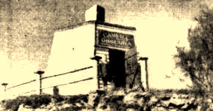
The Camera Obscura on Windy Point, Adelaide, as it was in August 1937.
Photo courtesy Trove.
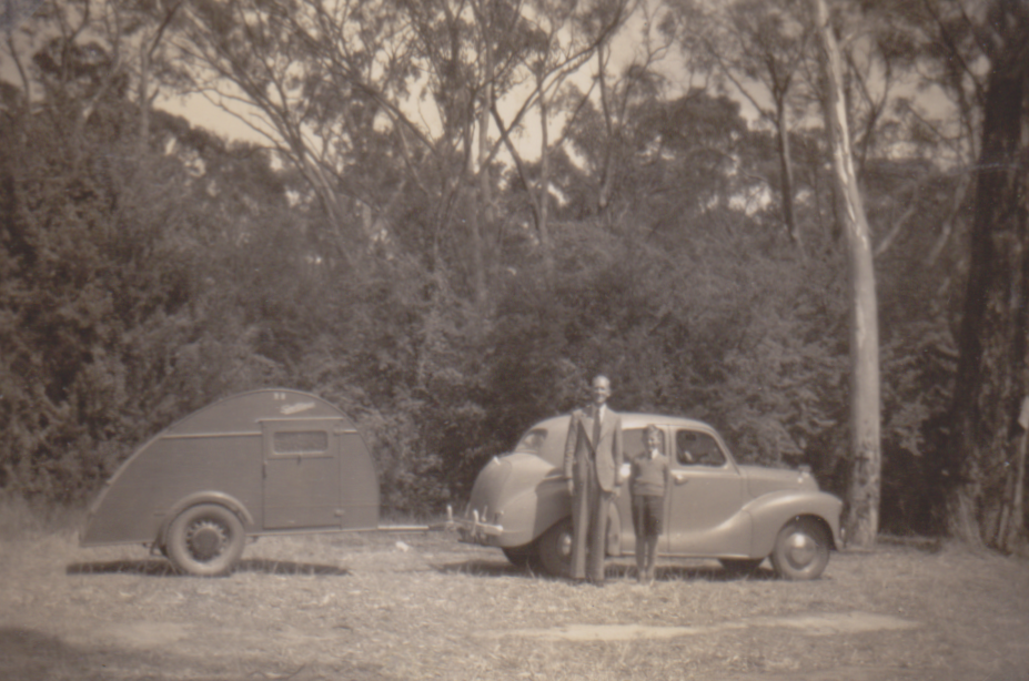
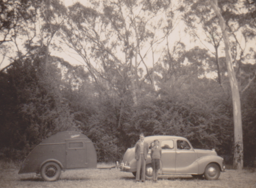
KangarooCreek Reservoir ?
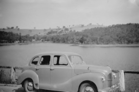
Austin A40 in unknown location near Adelaide, January 1951. It may be beside Kangaroo Creek Reseroir.
Any advice is welcome to [email protected]
